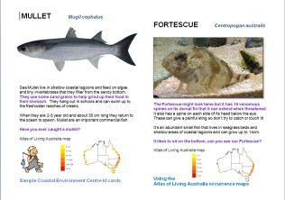
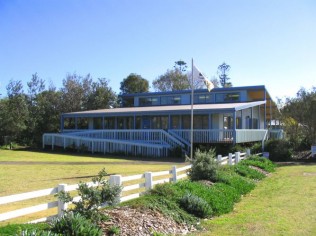
 Species occurrence data maps produced by the Atlas of Living Australia are being used by the Coastal Environment Centre (CEC) in North Narrabeen, NSW. The centre uses the maps on the animal cards that appear in the centre. Toni Wilson, Senior Educator at the centre, says “the cards describe a few interesting facts about the live animals in our tanks or the shells and other specimens on our touch tables.”
One of the core goals of the CEC is environmental education for schools. Visiting students have easy access to freshwater creeks, sand dunes, headlands, rock platforms, the ocean, urban bushland and wetlands.This allows students to experience hands-on learning about local ecosystems, coastal management issues and flora and fauna of the area through programs that meet curriculum requirements. Some of the centre’s activities contribute data to the Atlas of Living Australia through the ClimateWatch app.
The CEC is a regional community environmental learning centre, and Pittwater Council’s environmental flagship. More information can be found here www.pittwater.nsw.gov.au/cec.
