We have replaced the concept of an assemblage with Lists. A list, like the assemblage, is any combination of species but we have now formalized the generation, management and use of these lists. They key difference between the assemblage and the lists is that Lists are retained by the system for future use.
To use the full functionality of Lists, you must register on the Atlas site as the List is stored against your name. Lists are public but as a List owner, they can also be deleted after use.
A List can be created on the fly in the Spatial Portal or through the Lists page. You can share administrative functions with other registered ALA users: Lists can be edited by anyone given the authority. Taxa can be added, modified or deleted from the List and the List can be deleted if not required further.
NOTE: Lists created via the Spatial Portal (on the fly) are by default created as PRIVATE lists. This means that they will not be exposed on http://lists.ala.org.au. These private lists can be edited and shared using the Lists functionality. If they are temporary, please remove them once the project or exercise has been completed.
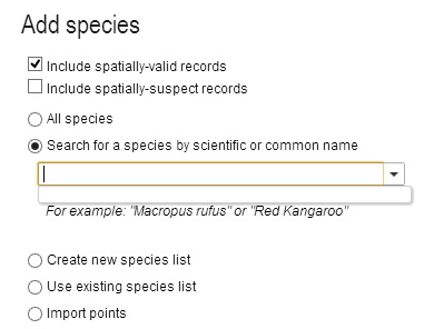
A List can be used anywhere a single species can be used. The options are
- All species
- Search for a species by scientific or common name
- Create a new List of species
- Use an existing List of species
- Upload points
Species List
A species List is a group of taxa/species. The Spatial Portal can create this list and generate one mapped layer that can be be used in the same way as a single species layer. For example, faceting, filtering, scatterplots, prediction, points to grid, GDM and exports.
A species List can be created on the fly by pasting in any combination of scientific or common names or LSIDs (Life Science Identifiers) into the species selection multi-line text box and pressing the ‘Add’ button.
The names or IDs will be looked in the National Species List and a message will be displayed for those not found. The look up accepts synonyms and will match on currently accepted names. If a species name does not exist in the National Species List, but the genus does, then it will create a match against the whole genera.
The returned records list of scientific names, includes those that are found and not found.
Create a Species List
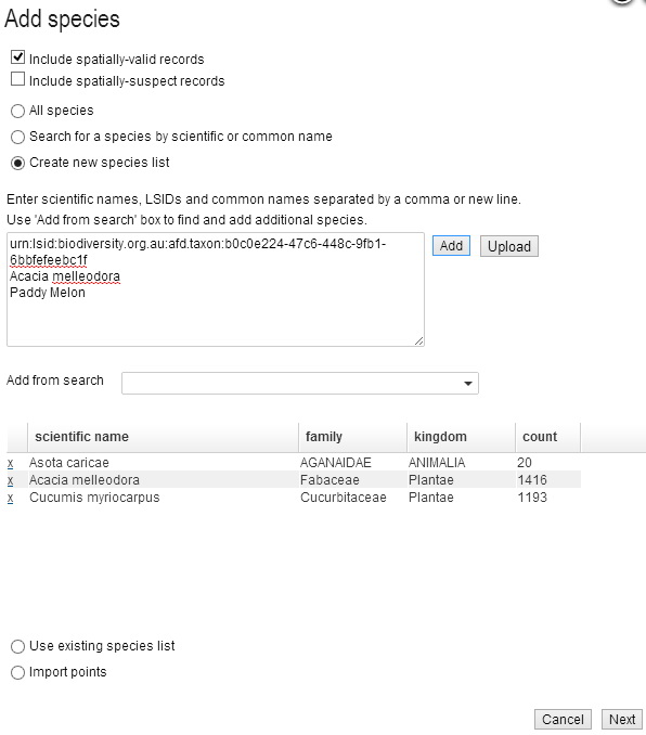
Press the ‘click to search’ in the family column for ‘not found’ species to copy the species into the ‘Add from search’ text field. This uses a different search system using ‘auto-complete’ so you may try removing a few letters to allow the search for close names.

You can build a List by using the ‘Add from search’ text field to add scientific names or common names, one by one. Common names found to be ambiguous, like ‘Tiger Moth’ in the figure above, will be added to the records list as ‘not found’.
Click to search in the records list, to copy the ‘not found’ common name into the species drop down list.
Once the List has been created, it will be saved and made public until you delete it.
Use an Existing Species List
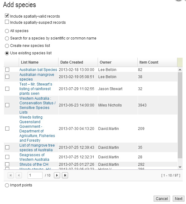
If a List has been previously created, it can be used wherever a single species/taxa can be used. The List may have been created by you or by another registered user. The list of Lists is displayed and one or more Lists can be selected for use. As noted above, regardless of the number of taxa, the List will be mapped as a single species layer with all associated occurrence records. You can subsequently facet the mapped layer on scientific name or a host of other features. This will display the classes of the facet as separate colour on the map. You can also create a new layer by filtering on a subset of classes of the facet.
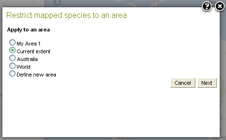
Limit to Area
‘Apply to an area’ limits the mapping of occurrence records to a predefined or a ‘defined on the fly’ area. See the image above. Defining a new area adds an area layer using any one of 14 options.
Click the ‘Next’ button.
Any predefined area (My Area) listed as a map layer in the top left layers list can be used for limiting the area used for mapping the species assemblage.
The figures below are examples of mapping multiple species by the use of Lists-
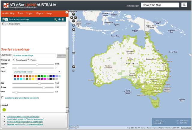
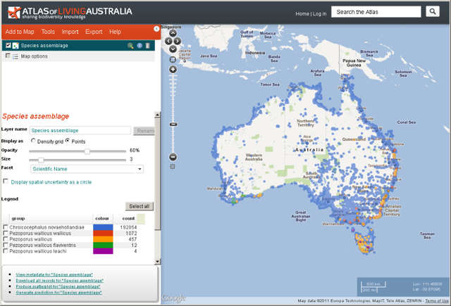
For more information on faceting and filtering »
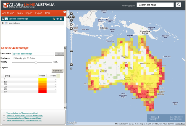
Click on the Display as ‘Density grid’ to change the map to display the species assemblage in one degree density grids. If the number of occurrences to be displayed on the map are 100,000 or over, then the map defaults to the density grid.
The legend show the species assemblage occurrence counts, e.g. 0 to 99, 100 to 199.
When the layer metadata icon ![]() icon is selected in the layers list for the species assemblage the metadata is displayed.
icon is selected in the layers list for the species assemblage the metadata is displayed.
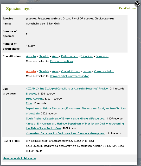
Demonstration Youtube Video
By Lee Belbin, Geospatial Team Leader
