By Ian McDonald –
 The other day I was asked over Twitter if the Atlas of Living Australia has developed any tools or resources which were suitable for school students. Well, we are happy to announce that Ecolinc, an initative of the Victorian Government, has done just that and developed a Field Guide app in collaboration with a variety of organisations including us, as a component of its educational online outreach program entitled Biodiversity of the Western Volcanic Plains.
The App can be downloaded here for free via the iTunes store.
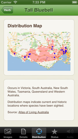
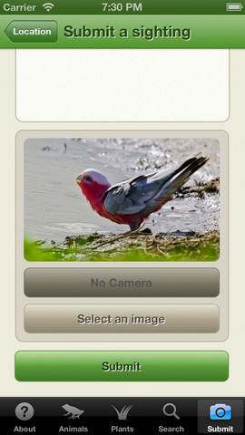
The App provides the opportunity for users to map and upload sightings of any of the listed species within the Western Volcanic Plains, to contribute to a growing database of sightings of both common and threatened grassland species. Sightings are mapped and displayed on the Ecolinc Biodiversity of the Western Volcanic Plains website, which provides additional resources and learning objects relevant to the biodiversity of grassland ecosystems within this region. These are designed to be used by school students and community members.
Ecolinc was established in 2005 to provide a wide range of exciting and engaging curriculum programs for prep to senior school students and teachers. It has an award winning Ecolinc facility which incorporates innovative ecologically sustainable design elements, providing the perfect venue and model for environmental teaching and learning. Ecolinc is set within a created indigenous grassy/woodland landscape featuring a model wetland, designed to intercept and filter stormwater, and to aid in cooling the facility in summer.
Onsite programs are a large part of the Ecolinc program but as you can see, they are now branching into different forms of educational initiatives. This is its first mobile App and is one of several learning objects which will comprise Ecolinc’s new online outreach program. However developing the App did not come easily or quickly, taking about a year to produce and with many challenges met along the way, the Director of Ecolinc, Suzanne Clark said she was always glad that the Atlas of Living Australia support staff were on hand to provide assistance for her and her staff, when required. A lot of the information within the App has come from sightings already uploaded to the Atlas of Living Australia website and better yet, new sightings which can be uploaded via the App, will also be uploaded to the Atlas website as a species sighting.
The App was initially designed to cover just the Werribee Plains of Victoria but covers all Western Volcanic Plains (Victorian Volcanic Plain). While it is currently only available for download on Apple products don’t be alarmed, you can also access and utilise the App features via any computer through the website – http://bwvp.ecolinc.vic.edu.au/
The Ecolinc initative all came about under the project “Vision for the Werribee Plains” grants program, made available by the Victorian Government – Department of Environment and Primary Industries who wanted to help promote sustainability initiatives across the Werribee Plains region. The developers of the App plan to expand the region it covers in a potential “version 2” and are working with colleagues from Melbourne University to hopefully cover the whole south east of Australia.
This is another great example of organisations using the Atlas of Living Australia resources for education and community engagement. Some screen shots from the App can be seen below.
Want more information about how this App was created?
Suzanne M Clark Director, Ecolinc PO Box 329 Bacchus Marsh Vic 3340 E: clark.suzanne.m@edumail.vic.gov.au P: (03) 5367 0171
