People conducting biodiversity surveys for environmental impact assessments (EIA) associated with development applications are required to submit survey data to relevant regulatory authorities as part of the approvals process. EIA is a costly process and sometimes, especially when multiple approvals are required, can take a long time and involve duplicated effort.
Approximately 500 biodiversity surveys are conducted for EIA in Western Australia each year. The data collected in these site assessments is often extensive and contains many valuable species records, spatial information and a survey report which interprets the data.
Until recently, this biodiversity data was not consolidated and was rarely shared. In acknowledgement of this situation, WA’s government, industry representatives and environmental consultants had been calling for a mechanism to make this biodiversity data more accessible and re-usable.
The IBSA solution
Led by the WA Department of Water and Environmental Regulation, the WA Environmental Protection Authority and the WA Department of Mines, Industry Regulation and Safety, in collaboration with the WA Biodiversity Science Institute (WABSI) and with the input of stakeholders including mining companies and environmental consultants, WA has established a nationally-leading programme for sharing the biodiversity survey data and metadata that result from environmental assessments.
The Atlas of Living Australia (ALA) was approached to provide the digital infrastructure solution and expertise in biodiversity data management and has played a key role in enabling the capture and distribution of this biodiversity information, which is critical for WA’s approvals process.
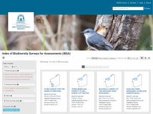
The result is IBSA – the Index of Biodiversity Surveys for Assessments – an online portal for land-based biodiversity survey data in Western Australia. IBSA is hosted on the ALA’s data collection tool, BioCollect. It provides a central public register of surveys moving through the approvals process and enables efficient data sharing by allowing data to be uploaded to projects and shared with all relevant stakeholders at the same time.
IBSA was launched in 2018 and one year on, we’re already seeing the impact it is having on data availability and usability in the sector.
Impact and outcomes
There are already almost 450 surveys in the IBSA system, with over 350 available in the public web portal while others await upload when the relevant assessments conclude.
The IBSA surveys represent over 180 different proponents from mining, agricultural, local government and other development types throughout Western Australia. The majority of assessments are associated with applications for permits to clear native vegetation, under assessment by the WA Department of Water and Environmental Regulation and the WA Department of Mines, Industry Regulation and Safety, while the remainder are associated with significant proposals under assessment by the WA Environmental Protection Authority.
More than half of the surveys in IBSA have data sets and reports attached that the relevant proponents have allowed to be published in full on the platform. Excitingly, in almost half of cases the proponent has licensed the survey data for re-use under a Creative Commons CC BY 3.0 licence – this means that, subject to some simple conditions, third parties can freely re-use the information for their own research or projects. This proportion is expected to increase as proponents become more familiar with the role of IBSA in the assessment process.
“The Index of Biodiversity Surveys for Assessments is a ground-breaking initiative that will promote the sharing of vital biodiversity data obtained as part of the environmental assessment process,” said WA Acting Environment Minister Hon Francis Logan BA (Hons) MLA.
“Creating a central and accessible index for this data will deliver greater efficiencies for the public and private sector, aid with decision making and most importantly it will have lasting benefits for Western Australia’s flora and fauna,” concluded Minister Logan.
Proponent data and the ALA
Flora and fauna occurrence data can also be accessed under licence from surveys in IBSA and imported into the state and national (ALA) biodiversity data repositories, where it can then be used for other biodiversity research and environmental decision making. Whilst this is not currently part of the IBSA process, the ALA is looking forward to being able to make the IBSA data more accessible and versatile for end-users.
The ALA’s broad user base – spanning ecoscience researchers, natural resource managers, and government departments – recognises the value of proponent data and is looking forward to the opportunity to access it on the ALA.
What is proponent data?
Biodiversity data contained in Environmental Impact Assessments submitted as part of development applications.
How IBSA works
Proponents (private development companies, environmental consultants etc) who conduct land-based biodiversity surveys to support applications for native vegetation clearing permits, works approvals and licences; or referrals to regulatory authorities of proposals and schemes are required to submit an electronic data package.
The relevant agencies then submit the data to IBSA during the assessment or compliance process on the proponent’s behalf.
Once data has been used for assessment purposes, WA Department of Water and Environmental Regulation makes basic information for each data set – the metadata – available online via IBSA. Data owners have control over how accessible the complete data sets are.
For more information about IBSA:
- visit the Index of Biodiversity Surveys for Assessments
- watch an IBSA familiarisation session presentation
- access the IBSA portal